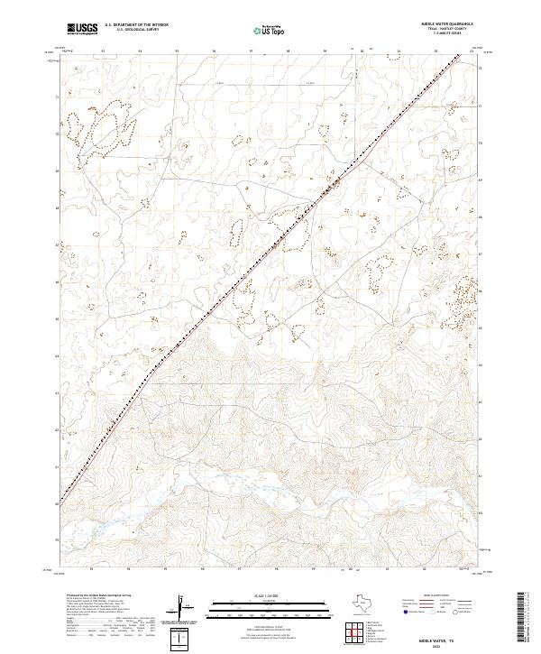
2022 Map of Middle Water
USGS Topo · Published 2022About this map
Punta de Agua Cr defines the southern drainage of this High Plains landscape in Hartley County. This 2022 survey illustrates a sparsely populated ranching and agricultural corridor where modern county roads create a precise grid across the undulating terrain. A primary transportation artery bisects the map diagonally from the southwest to the northeast, intersecting with local routes such as Co Rd 13 and Brown Rd. The map reveals a highly structured approach to land division in the Texas Panhandle, with Co Rd N and Co Rd 16 providing access to the vast open acreage between the creek bed and the upland plateaus. The topography is characterized by the contrast between the flat tablelands and the complex series of small draws and breaks that feed into the main waterway.
Find a feature on this map
5 named features on this map. Tap any name to fly to it.
Don’t see what you’re looking for? This feature index may not catch every label — zoom into the map to look around manually.
Map Details
Editions of this 2022 Middle Water Map
This is the sole edition of this map. No revisions or reprints were ever made.
Other maps of this area

1954 · Tucumcari
USGS Topo · 1:250,000

1958 · Tucumcari
USGS Topo · 1:250,000

1971 · Middle Water
USGS Topo · 1:24,000

1971 · Syndicate Hills
USGS Topo · 1:24,000

1971 · Beck Ranch
USGS Topo · 1:24,000

1971 · Whiteaker Ranch
USGS Topo · 1:24,000

1971 · Spring Creek Ranch
USGS Topo · 1:24,000
1971 · Romero
USGS Topo · 1:24,000

1971 · Pedarosa Camp
USGS Topo · 1:24,000

1973 · King SW
USGS Topo · 1:24,000