
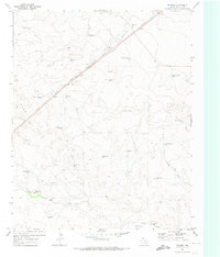
1971 Map of Middle Water
USGS Topo · Published 1973About this map
The High Plains of Hartley County are defined here by the diagonal passage of the Chicago Rock Island and Pacific railroad, which anchors the small community of Middle Water. In this semi-arid landscape, the distribution of water is the primary driver of human settlement and ranching operations. The map documents a sophisticated network of water sources, from family-named features like Harder Well and Salthouse Well to landmarks such as the Steel Windmill and Red Windmill.
Find a feature on this map
18 named features on this map. Tap any name to fly to it.
Don’t see what you’re looking for? This feature index may not catch every label — zoom into the map to look around manually.
Map Details
Editions of this 1971 Middle Water Map
This is the sole edition of this map. No revisions or reprints were ever made.
Other maps of this area

1954 · Tucumcari
USGS Topo · 1:250,000

1958 · Tucumcari
USGS Topo · 1:250,000

1971 · Syndicate Hills
USGS Topo · 1:24,000

1971 · Beck Ranch
USGS Topo · 1:24,000

1971 · Whiteaker Ranch
USGS Topo · 1:24,000

1971 · Spring Creek Ranch
USGS Topo · 1:24,000
1971 · Romero
USGS Topo · 1:24,000

1971 · Pedarosa Camp
USGS Topo · 1:24,000

1973 · King SW
USGS Topo · 1:24,000

1973 · King
USGS Topo · 1:24,000