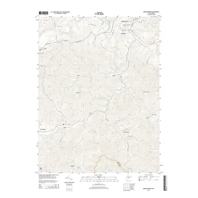
2014 Map of Middlebourne
USGS Topo · Published 2014About this map
Middlebourne serves as the focal point of this Tyler County survey, situated along the winding course of Middle Island Creek. The settlement pattern reflects the traditional Appalachian ridge-and-hollow landscape, with small communities like Wick, Bearsville, and McKim established near the creek bottoms and many family or local landmarks located on the higher elevations, such as Klondike Ridge. This 2014 edition documents the road networks connecting these dispersed settlements, including WV-18 and numerous county roads like Bearsville Rd. Genealogy researchers will find several notable burial sites recorded, including Middlebourne Cem, Mt Pleasant Cem, and Fairview Cem. The hydrography is particularly dense, with numerous branches such as Sancho Creek and Freeland Run feeding into the larger creek system, illustrating the complex drainage of the northern West Virginia hills.
Find a feature on this map
81 named features on this map. Tap any name to fly to it.
Don’t see what you’re looking for? This feature index may not catch every label — zoom into the map to look around manually.
Map Details
Editions of this 2014 Middlebourne Map
This is the sole edition of this map. No revisions or reprints were ever made.
Other maps of this area

1905 · West Union
USGS Topo · 1:62,500

1905 · New Matamoras
USGS Topo · 1:62,500

1906 · Saint Marys
USGS Topo · 1:62,500

1906 · New Martinsville
USGS Topo · 1:62,500

1924 · St Marys
USGS Topo · 1:62,500

1924 · New Martinsville
USGS Topo · 1:62,500

1924 · New Matamoras
USGS Topo · 1:62,500

1924 · West Union
USGS Topo · 1:62,500

1926 · New Martinsville
USGS Topo · 1:62,500

1926 · New Matamoras
USGS Topo · 1:62,500