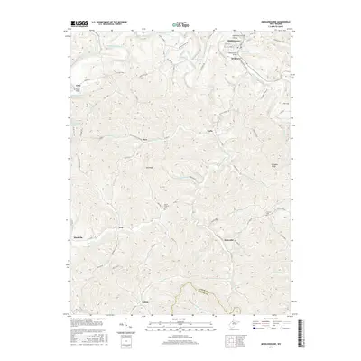
2016 Map of Middlebourne
USGS Topo · Published 2016About this map
Middlebourne, the county seat of Tyler County, occupies a sharp bend in Middle Island Creek where the Middlebourne Bridge and Hissom Bridge span the waterway. This West Virginia landscape is defined by its dendritic drainage pattern, where numerous runs and forks such as Sancho Creek, Foster Run, and Gorrell Run have carved deep valleys between prominent high points like Owlshead and Klondike Ridge. The map documents a rural network of named ridge roads and hollow routes, connecting small crossroads settlements including Bearsville, Wick, and McKim.
Find a feature on this map
91 named features on this map. Tap any name to fly to it.
Don’t see what you’re looking for? This feature index may not catch every label — zoom into the map to look around manually.
Map Details
Editions of this 2016 Middlebourne Map
This is the sole edition of this map. No revisions or reprints were ever made.
Other maps of this area

1905 · West Union
USGS Topo · 1:62,500

1905 · New Matamoras
USGS Topo · 1:62,500

1906 · Saint Marys
USGS Topo · 1:62,500

1906 · New Martinsville
USGS Topo · 1:62,500

1924 · St Marys
USGS Topo · 1:62,500

1924 · New Martinsville
USGS Topo · 1:62,500

1924 · New Matamoras
USGS Topo · 1:62,500

1924 · West Union
USGS Topo · 1:62,500

1926 · New Martinsville
USGS Topo · 1:62,500

1926 · New Matamoras
USGS Topo · 1:62,500