1976 Map of Middlebourne
USGS Topo · Published 1979About this map
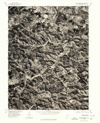
Middle Island Creek winds through the hills of Tyler County in this orthophotoquad, which uses aerial photography to depict the West Virginia landscape as it appeared in the mid-1970s. The county seat of Middlebourne occupies a prominent bend in the creek at the top of the map, showing the dense residential and commercial structure of the town before it gives way to the heavily wooded ridges and narrow valleys characteristic of the region. Further south, the small settlement of Wick is visible, positioned along the rural road networks that navigate the uneven terrain. Because this document is an orthophoto rather than a traditional line-drawn map, it provides an unfiltered view of land use, revealing the exact boundaries of timber stands, agricultural clearings, and the intricate drainage patterns that define this section of the state.
Find a feature on this map
3 named features on this map. Tap any name to fly to it.
Don’t see what you’re looking for? This feature index may not catch every label — zoom into the map to look around manually.
Map Details
Editions of this 1976 Middlebourne Map
This is the sole edition of this map. No revisions or reprints were ever made.
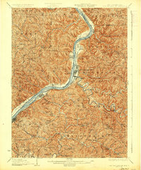
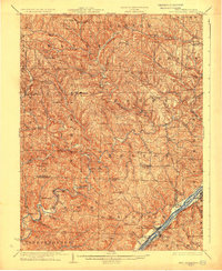
Other maps of this area

1905 · West Union
USGS Topo · 1:62,500

1905 · New Matamoras
USGS Topo · 1:62,500

1906 · Saint Marys
USGS Topo · 1:62,500

1906 · New Martinsville
USGS Topo · 1:62,500

1924 · St Marys
USGS Topo · 1:62,500

1924 · New Martinsville
USGS Topo · 1:62,500

1924 · New Matamoras
USGS Topo · 1:62,500

1924 · West Union
USGS Topo · 1:62,500
1926 · New Martinsville
USGS Topo · 1:62,500
1926 · New Matamoras
USGS Topo · 1:62,500