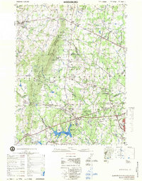
1977 Map of Middleburg
USGS Topo · Published 1979About this map
The Manassas National Battlefield Park preserves a complex network of American history across this landscape, where landmarks like the Stone Bridge and Stone House stand alongside ridges named Stony Ridge and Matthews Hill. By the late 1970s, the rural character of the Piedmont was beginning to shift, yet the map still captures numerous traditional hubs like Middleburg, Aldie, and Haymarket. The terrain is defined by the Bull Run Mountains, which create a natural boundary between Loudoun and Prince William counties, punctuated by gaps and family-named features like Griffin Mtn.
Find a feature on this map
83 named features on this map. Tap any name to fly to it.
Don’t see what you’re looking for? This feature index may not catch every label — zoom into the map to look around manually.
Map Details
Editions of this 1977 Middleburg Map
This is the sole edition of this map. No revisions or reprints were ever made.
Other maps of this area

1884 · Harpers Ferry
USGS Topo · 1:125,000

1890 · Mt. Vernon
USGS Topo · 1:125,000

1891 · Harpers Ferry
USGS Topo · 1:125,000

1891 · Mt. Vernon
USGS Topo · 1:125,000

1893 · Frederick
USGS Topo · 1:125,000

1893 · Harpers Ferry
USGS Topo · 1:125,000

1894 · Warrenton
USGS Topo · 1:125,000

1894 · Frederick
USGS Topo · 1:125,000

1894 · Warrenton
USGS Topo · 1:62,500

1894 · Mt. Vernon
USGS Topo · 1:125,000