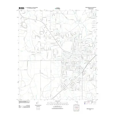
2012 Map of Middleburg SW
USGS Topo · Published 2012About this map
The Camp Blanding Military Res occupies a substantial portion of the southwestern corner of this Clay County landscape, marking the edge of a vast managed wilderness. The terrain is defined by a dense network of blackwater tributaries, including the N Fork Black Cr and its various branches such as Big Br and Boggy Br. This 2012 survey illustrates the residential expansion of the Middleburg area, where modern street grids increasingly border traditional family lands and landmarks. Aviation and genealogy are prominent themes here; small private airfields like Spencer's Airpark and Williams Field Airport sit alongside older local legacy sites. Genealogists will find several notable burial grounds mapped in detail, specifically Padget Cem, Johns Cem, and Fowler Cem, providing spatial context for local family histories along the winding banks of Mill Creek.
Find a feature on this map
250 named features on this map. Tap any name to fly to it.
Don’t see what you’re looking for? This feature index may not catch every label — zoom into the map to look around manually.
Map Details
Editions of this 2012 Middleburg SW Map
This is the sole edition of this map. No revisions or reprints were ever made.
Other maps of this area

1918 · Middleburg
USGS Topo · 1:62,500

1918 · Lawtey
USGS Topo · 1:62,500

1941 · Starke
USGS Topo · 1:62,500

1941 · Middleburg
USGS Topo · 1:62,500

1942 · Ates Creek
USGS Topo · 1:62,500

1948 · Starke
USGS Topo · 1:50,000

1948 · Jacksonville
USGS Topo · 1:250,000

1949 · Middleburg SW
USGS Topo · 1:24,000

1949 · Fiftone
USGS Topo · 1:24,000

1949 · Starke
USGS Topo · 1:24,000