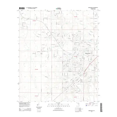
2015 Map of Middleburg SW
USGS Topo · Published 2015About this map
Middleburg and its surrounding Clay County landscape are defined by a complex network of waterways, including the North Fork Black Creek and numerous tributaries like Boggy Br and Duckwater Br. The settlement pattern in this 2015 survey reflects a mix of suburban expansion and long-standing rural roots, evidenced by the density of neighborhood streets branching off CR-218 contrasted with legacy family burial grounds. Local history and genealogy are well-represented by several small cemeteries scattered across the townships, such as Padget Cem, Johns Cem, and Oak Grove Cem. Aviation activity is marked by Spencer's Airpark to the west and Williams Field to the east, while the southern reaches of the map near Bull Cr and Mill Cr maintain a more open, hydrologically influenced character.
Find a feature on this map
231 named features on this map. Tap any name to fly to it.
Don’t see what you’re looking for? This feature index may not catch every label — zoom into the map to look around manually.
Map Details
Editions of this 2015 Middleburg SW Map
This is the sole edition of this map. No revisions or reprints were ever made.
Other maps of this area

1918 · Middleburg
USGS Topo · 1:62,500

1918 · Lawtey
USGS Topo · 1:62,500

1941 · Starke
USGS Topo · 1:62,500

1941 · Middleburg
USGS Topo · 1:62,500

1942 · Ates Creek
USGS Topo · 1:62,500

1948 · Starke
USGS Topo · 1:50,000

1948 · Jacksonville
USGS Topo · 1:250,000

1949 · Middleburg SW
USGS Topo · 1:24,000

1949 · Fiftone
USGS Topo · 1:24,000

1949 · Starke
USGS Topo · 1:24,000