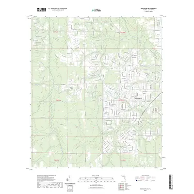
2023 Map of Middleburg SW
USGS Topo · Published 2023About this map
Middleburg serves as a focal point in this portion of Clay County, situated near the confluence of several vital waterways including the North Fork Black Creek and Mill Creek. The landscape is defined by its riparian networks, where smaller tributaries like Big Branch and Duckwater Branch carve through the terrain. For those researching local lineages, the map identifies several burial grounds such as Oak Grove Cem, Fowler Cem, Johns Cem, and Padget Cem, many of which are tucked away near established routes like Co RD 218. The presence of Spencer's Airpark and Williams Field highlights the area's mixed-use character, balancing rural forest lands and aviation with growing residential grids. Public land use is represented by the Jennings State Forest Trl, which borders the northern reaches near the distinctive elevation of Knob Hill.
Find a feature on this map
246 named features on this map. Tap any name to fly to it.
Don’t see what you’re looking for? This feature index may not catch every label — zoom into the map to look around manually.
Map Details
Editions of this 2023 Middleburg SW Map
This is the sole edition of this map. No revisions or reprints were ever made.
Other maps of this area

1918 · Middleburg
USGS Topo · 1:62,500

1918 · Lawtey
USGS Topo · 1:62,500

1941 · Starke
USGS Topo · 1:62,500

1941 · Middleburg
USGS Topo · 1:62,500

1942 · Ates Creek
USGS Topo · 1:62,500

1948 · Starke
USGS Topo · 1:50,000

1948 · Jacksonville
USGS Topo · 1:250,000

1949 · Middleburg SW
USGS Topo · 1:24,000

1949 · Fiftone
USGS Topo · 1:24,000

1949 · Starke
USGS Topo · 1:24,000