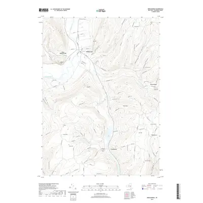
2019 Map of Middleburgh
USGS Topo · Published 2019About this map
Schoharie Creek carves a deep valley through this Schoharie County landscape, defining the character of Middleburgh and West Middleburgh. The valley floor is framed by dramatic elevation changes at The Cliff, The Gorge, and the distinctive Vromans Nose, while the southern reaches transition into the wetlands of The Vlaie. This 2019 survey documents the enduring rural settlement patterns of the Catskill foothills, where small hamlets like Huntersland and Franklinton are connected by narrow winding roads such as Gates Hill Rd W and Huntersland Rd. Genealogy interest is high here, with numerous small family and community burial grounds scattered across the heights, including Cotton Hill Cem and the Huntersland School Cem. The map provides a clear record of the modern road network superimposed over the historic upland topography of Armlin Hill and Dutton Ridge.
Find a feature on this map
95 named features on this map. Tap any name to fly to it.
Don’t see what you’re looking for? This feature index may not catch every label — zoom into the map to look around manually.
Map Details
Editions of this 2019 Middleburgh Map
This is the sole edition of this map. No revisions or reprints were ever made.
Other maps of this area

1893 · Durham
USGS Topo · 1:62,500

1894 · Durham
USGS Topo · 1:62,500

1898 · Schoharie
USGS Topo · 1:62,500

1900 · Schoharie
USGS Topo · 1:62,500

1900 · Schoharie
USGS Topo · 1:31,680

1900 · Berne
USGS Topo · 1:62,500

1901 · Gilboa
USGS Topo · 1:62,500

1903 · Gilboa
USGS Topo · 1:62,500

1903 · Berne
USGS Topo · 1:62,500

1943 · Cobleskill
USGS Topo · 1:24,000