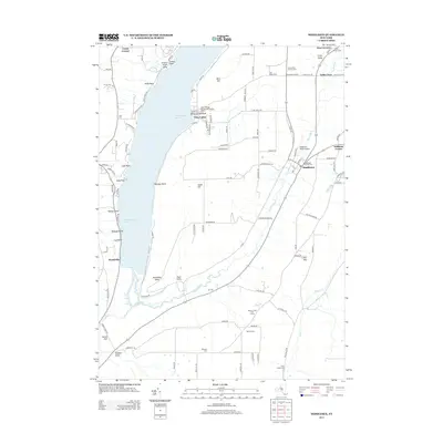
2013 Map of Middlesex
USGS Topo · Published 2013About this map
Canandaigua Lake dominates the western edge of this landscape, its shoreline defined by family-named points such as Cook Point, Whiskey Point, and Granger Point. The rugged topography of the Finger Lakes region is evident in the deep cuts of Clark Gully and Conklin Gully, which drain toward the West River valley. This 2013 survey illustrates a rural community anchored by the settlement of Middlesex, where the Middlesex Valley Airport and Middlesex Center Cem serve as local landmarks. The eastern portion of the map is characterized by high ground like Bare Hill and South Hill, with the Hi-Tor Preserve protecting significant acreage. Genealogists will find several burial grounds scattered across the terrain, including Coye Cem, Lee Cem, and the remote Johnson Cem, reflecting a long history of upland farming and settlement.
Find a feature on this map
112 named features on this map. Tap any name to fly to it.
Don’t see what you’re looking for? This feature index may not catch every label — zoom into the map to look around manually.
Map Details
Editions of this 2013 Middlesex Map
This is the sole edition of this map. No revisions or reprints were ever made.
Other maps of this area

1900 · Naples
USGS Topo · 1:62,500

1900 · Canandaigua
USGS Topo · 1:62,500

1902 · Phelps
USGS Topo · 1:62,500

1903 · Naples
USGS Topo · 1:62,500

1903 · Canandaigua
USGS Topo · 1:62,500

1903 · Penn Yan
USGS Topo · 1:62,500

1913 · Naples
USGS Topo · 1:62,500

1942 · Naples
USGS Topo · 1:31,680

1942 · Prattsburg
USGS Topo · 1:31,680
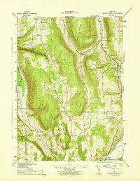
1942 · Bristol Springs
USGS Topo · 1:31,680