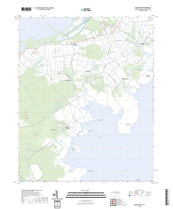
2022 Map of Middletown
USGS Topo · Published 2022About this map
The marshy lowlands of Hyde County meet the open waters of the Pamlico Sound in this detailed 2022 survey. Small, historic communities are scattered across the drainage-reliant landscape, including Lake Landing on the southeastern edge of Lake Mattamuskeet and the evocatively named Last Chance. The map reveals a complex network of artificial waterways like the Rose Canal, Gray Ditch, and Great Ditch Rd, which have historically been essential for managing the high water table of this coastal plain environment.
Find a feature on this map
47 named features on this map. Tap any name to fly to it.
Don’t see what you’re looking for? This feature index may not catch every label — zoom into the map to look around manually.
Map Details
Editions of this 2022 Middletown Map
This is the sole edition of this map. No revisions or reprints were ever made.
Other maps of this area

1943 · Columbia
USGS Topo · 1:125,000

1943 · Roanoke Island
USGS Topo · 1:125,000

1951 · Middletown Anchorage
USGS Topo · 1:24,000
1951 · Bluff Point
USGS Topo · 1:24,000

1951 · Middletown
USGS Topo · 1:24,000

1951 · Engelhard West
USGS Topo · 1:24,000

1951 · New Holland
USGS Topo · 1:24,000

1951 · Engelhard East
USGS Topo · 1:24,000

1951 · Fairfield
USGS Topo · 1:24,000

1953 · Rocky Mount
USGS Topo · 1:250,000