
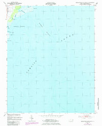
1951 Map of Middletown Anchorage
USGS Topo · Published 1952About this map
Lake Landing and the coastal waters of Pamlico Sound define this early 1950s survey of the Hyde County shoreline. The map focuses heavily on the maritime geography of Middletown Anchorage, where depth soundings and underwater contours trace the submerged profile of Gibbs Shoal. This area represents a critical intersection of land and water, where the intricate network of inlets such as Middletown Creek, Back Creek, and Long Tree Creek provided natural drainage and navigation for the surrounding wetlands.
Find a feature on this map
12 named features on this map. Tap any name to fly to it.
Don’t see what you’re looking for? This feature index may not catch every label — zoom into the map to look around manually.
Map Details
Editions of this 1951 Middletown Anchorage Map
2 editions found
Other maps of this area

1943 · Columbia
USGS Topo · 1:125,000

1943 · Roanoke Island
USGS Topo · 1:125,000

1951 · Middletown
USGS Topo · 1:24,000

1951 · Engelhard West
USGS Topo · 1:24,000

1951 · Long Shoal Point
USGS Topo · 1:24,000

1951 · Engelhard East
USGS Topo · 1:24,000

1953 · Rocky Mount
USGS Topo · 1:250,000

1954 · Rocky Mount
USGS Topo · 1:250,000

1955 · Wanchese
USGS Topo · 1:250,000

1957 · Manteo
USGS Topo · 1:250,000