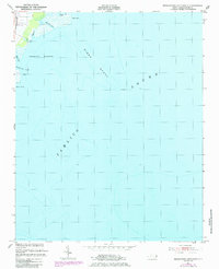
1951 Map of Middletown Anchorage
USGS Topo · Published 1985About this map
Gibbs Point and the low-lying marshes of Hyde County define this aquatic landscape where the mainland meets the expansive Pamlico Sound. This survey, based on 1940s photography and 1950s field checks, reveals a coastal environment dominated by tidal waterways and maritime navigation hazards. The charting of Gibbs Shoal and the presence of a light south of the shoal indicate the critical nature of these waters for local mariners and commercial fishermen. Several small drainages, including Middletown Creek, Lone Tree Creek, and Burrus Cr, carve into the shoreline, illustrating the delicate interface between the sound and the mainland. The area designated as Middletown Anchorage highlights a specific zone of historical maritime utility, providing a sheltered location for vessels within the often-turbulent sound waters.
Find a feature on this map
11 named features on this map. Tap any name to fly to it.
Don’t see what you’re looking for? This feature index may not catch every label — zoom into the map to look around manually.
Map Details
Editions of this 1951 Middletown Anchorage Map
2 editions found
Other maps of this area

1943 · Columbia
USGS Topo · 1:125,000

1943 · Roanoke Island
USGS Topo · 1:125,000

1951 · Middletown Anchorage
USGS Topo · 1:24,000

1951 · Middletown
USGS Topo · 1:24,000

1951 · Engelhard West
USGS Topo · 1:24,000

1951 · Long Shoal Point
USGS Topo · 1:24,000

1951 · Engelhard East
USGS Topo · 1:24,000

1953 · Rocky Mount
USGS Topo · 1:250,000

1954 · Rocky Mount
USGS Topo · 1:250,000

1955 · Wanchese
USGS Topo · 1:250,000