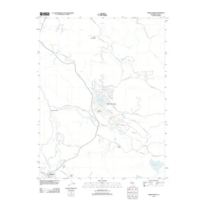
2012 Map of Middletown
USGS Topo · Published 2012About this map
Hidden Valley Lake serves as the centerpiece of this residential and recreational landscape in Lake County. The community is defined by its water features, including Stienhart Lakes, Lake Burgundy, and McCreary Lake, while the Hidden Valley Lake Golf Course occupies the valley floor between Coyote Creek and Putah Creek. To the southwest, the town of Middletown sits near the junction of Saint Helena Creek and Dry Creek, serving as a gateway to the surrounding valleys. The geography here is marked by distinct topographical basins such as Little High Valley, Coyote Valley, and Long Valley. Local industry and land use are visible through features like Channing Rudd Cellars and several ranch-named roads, including Noble Ranch Road and Stinson Ranch Road, reflecting the area's agricultural character near the rugged Cockerell Canyon.
Find a feature on this map
64 named features on this map. Tap any name to fly to it.
Don’t see what you’re looking for? This feature index may not catch every label — zoom into the map to look around manually.
Map Details
Editions of this 2012 Middletown Map
This is the sole edition of this map. No revisions or reprints were ever made.
Other maps of this area

1927 · Calistoga
USGS Topo · 1:62,500

1942 · St. Helena
USGS Topo · 1:62,500

1943 · Morgan Valley
USGS Topo · 1:62,500

1943 · Calistoga
USGS Topo · 1:62,500

1944 · Morgan Valley
USGS Topo · 1:62,500

1945 · Calistoga
USGS Topo · 1:62,500

1945 · St. Helena
USGS Topo · 1:62,500

1945 · Lower Lake
USGS Topo · 1:62,500

1947 · Santa Rosa
USGS Topo · 1:250,000

1949 · Santa Rosa
USGS Topo · 1:250,000