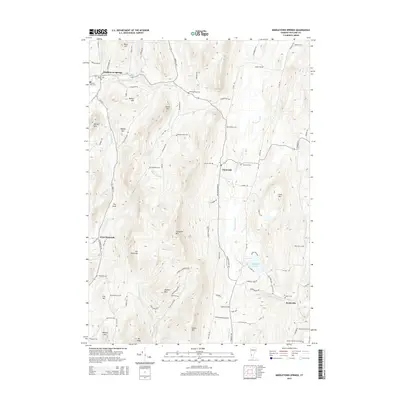
2015 Map of Middletown Springs
USGS Topo · Published 2015About this map
Middletown Springs and the village of Tinmouth anchor this 2015 study of the Vermont landscape, where the Poultney River and Clarendon River drain the high peaks of the Taconic Range. The geography is defined by prominent elevations like Tinmouth Mtn and Spoon Mtn, separated by the deep cleft known as The Gulf. This modern survey provides a detailed inventory of the area's rural cemetery network, which is vital for genealogical research. Family and community burial sites such as Darling-Rising Cem, Wood-Norton Cem, and the Noble Cem are clearly marked alongside more central locations like the Old Cem in Middletown Springs. Settlement patterns follow the valley floors near Scottsville and West Tinmouth, while high-altitude tracts like The Purchase remain sparsely developed. The inclusion of features such as Chipman Lake and the various brooks feeding the larger river systems highlights the essential water resources that have shaped this region's agriculture and habitation for generations.
Find a feature on this map
100 named features on this map. Tap any name to fly to it.
Don’t see what you’re looking for? This feature index may not catch every label — zoom into the map to look around manually.
Map Details
Editions of this 2015 Middletown Springs Map
This is the sole edition of this map. No revisions or reprints were ever made.
Other maps of this area

1891 · Rutland
USGS Topo · 1:62,500

1893 · Wallingford
USGS Topo · 1:62,500

1893 · Rutland
USGS Topo · 1:62,500

1894 · Pawlet
USGS Topo · 1:62,500

1895 · Castleton
USGS Topo · 1:62,500

1897 · Pawlet
USGS Topo · 1:62,500

1897 · Castleton
USGS Topo · 1:62,500

1903 · Mettawee
USGS Topo · 1:125,000

1950 · Glens Falls
USGS Topo · 1:250,000

1955 · Wallingford
USGS Topo · 1:62,500