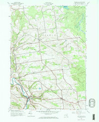
2023 Map of Middleville
USGS Topo · Published 2023About this map
West Canada Creek winds through the valley at Middleville, defining a landscape where rural hamlets like Norway and Fairfield remain connected by a dense network of traditional routes including Platform Rd and Newport-Gray Rd. The map reveals a remarkable concentration of ancestral burial grounds, such as Norway Rural Cem and Fairfield Cem East, which serve as vital markers of the area's pioneer heritage. Rising above the agricultural lowlands, distinctive peaks such as Woodchuck Hill and Dairy Hill frame the watershed, while Huckleberry Swamp provides a preserved pocket of the original marshy terrain. The presence of smaller, historically distinct locales like Old City and Hurricane underscores the enduring nature of settlement patterns in this part of Herkimer County, where geography has long dictated the placement of roads and homesteads.
Find a feature on this map
70 named features on this map. Tap any name to fly to it.
Don’t see what you’re looking for? This feature index may not catch every label — zoom into the map to look around manually.
Map Details
Editions of this 2023 Middleville Map
This is the sole edition of this map. No revisions or reprints were ever made.
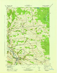
Historical Maps of Hurricane Through Time
3 maps found