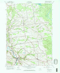
1943 Map of Middleville
USGS Topo · Published 1969About this map
West Canada Creek and the New York Central railroad corridor define the valley landscape of Herkimer County during the mid-1940s. This survey, based on 192 aerial photography, captures the concentrated settlement of Middleville as a local hub for transport and industry. The surrounding uplands are marked by the agricultural and educational infrastructure of the period, including Black Creek Sch and Dairy Hill Sch, alongside rural centers like Norway and Fairfield. A transition into the southern reaches of the Adirondack State Park is visible in the northeast, where Hackleberry Swamp and Spruce Creek signal a shift toward the wilderness. The map preserves the locations of generational landmarks, from Sweet Cem to the remote Lookout Tower on the heights above the Dairy Hill area.
Find a feature on this map
31 named features on this map. Tap any name to fly to it.
Don’t see what you’re looking for? This feature index may not catch every label — zoom into the map to look around manually.
Map Details
Editions of this 1943 Middleville Map
Other maps of this area

1897 · Remsen
USGS Topo · 1:62,500

1898 · Utica
USGS Topo · 1:62,500

1900 · Little Falls
USGS Topo · 1:62,500

1900 · Utica
USGS Topo · 1:62,500

1900 · Remsen
USGS Topo · 1:62,500

1900 · Wilmurt
USGS Topo · 1:62,500

1902 · Wilmurt
USGS Topo · 1:62,500

1903 · Little Falls
USGS Topo · 1:62,500

1939 · Little Falls
USGS Topo · 1:62,500

1943 · Newport
USGS Topo · 1:24,000