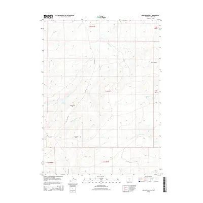
2015 Map of Middlewood Hill
USGS Topo · Published 2015About this map
The Continental Divide traverses this high-elevation landscape in southern Wyoming, dictating the flow of the intricate drainage networks that define the terrain. To the north and west, Sage Cr and its tributaries, such as Rasmussen Cr and Middlewood Cr, carve through the upland, while south of the divide, Little Jack Cr and Low Cr flow toward the Low Reservoir. The prominent Middlewood Hill stands as a significant landmark near the center of the sheet, surrounded by isolated water features like Adams Reservoir and the uniquely named Midget Geyser. The area’s sparse road network, consisting of Sage Creek Rd, McCarty Canyon Rd, and Jack Creek Rd, suggests a landscape primarily dedicated to ranching and resource management. Long-established cattle-country landmarks like Round Meadow provide context for the historical use of these high plains and foothills in Carbon County.
Find a feature on this map
23 named features on this map. Tap any name to fly to it.
Don’t see what you’re looking for? This feature index may not catch every label — zoom into the map to look around manually.
Map Details
Editions of this 2015 Middlewood Hill Map
This is the sole edition of this map. No revisions or reprints were ever made.
Other maps of this area

1932 · Savery
USGS Topo · 1:96,000

1940 · Savery
USGS Topo · 1:125,000

1954 · Rawlins
USGS Topo · 1:250,000

1956 · Bridger Pass
USGS Topo · 1:62,500

1956 · Bolten Ranch
USGS Topo · 1:62,500

1958 · Rawlins
USGS Topo · 1:250,000

1961 · Divide Peak
USGS Topo · 1:24,000

1961 · Middlewood Hill
USGS Topo · 1:24,000

1961 · Pine Grove Ranch
USGS Topo · 1:24,000

1961 · Jack Creek Reservoir
USGS Topo · 1:24,000