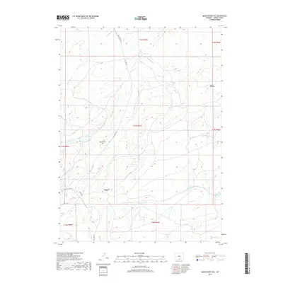
2017 Map of Middlewood Hill
USGS Topo · Published 2017About this map
The Continental Divide winds through this high-elevation terrain in Carbon County, defining the hydrologic split of the region. Watercourses such as Rasmussen Cr, Sage Cr, and Trapper Cr drain the slopes of Middlewood Hill, which rises as a prominent landmark in the center of the sheet. The landscape is characterized by its high meadows and unique geological features, notably the Midget Geyser and the expansive Round Meadow to the northeast. Human infrastructure is limited to primitive routes like Sage Creek Rd and McCarty Canyon Rd, alongside water management features including Adams Reservoir and Low Reservoir. This 2017 edition by the U.S. Geological Survey captures the modern state of these remote public lands, including the headwaters of numerous small drainages like Little Jack Cr and Beaver Cr.
Find a feature on this map
24 named features on this map. Tap any name to fly to it.
Don’t see what you’re looking for? This feature index may not catch every label — zoom into the map to look around manually.
Map Details
Editions of this 2017 Middlewood Hill Map
This is the sole edition of this map. No revisions or reprints were ever made.
Other maps of this area

1932 · Savery
USGS Topo · 1:96,000

1940 · Savery
USGS Topo · 1:125,000

1954 · Rawlins
USGS Topo · 1:250,000

1956 · Bridger Pass
USGS Topo · 1:62,500

1956 · Bolten Ranch
USGS Topo · 1:62,500

1958 · Rawlins
USGS Topo · 1:250,000

1961 · Divide Peak
USGS Topo · 1:24,000

1961 · Middlewood Hill
USGS Topo · 1:24,000

1961 · Pine Grove Ranch
USGS Topo · 1:24,000

1961 · Jack Creek Reservoir
USGS Topo · 1:24,000