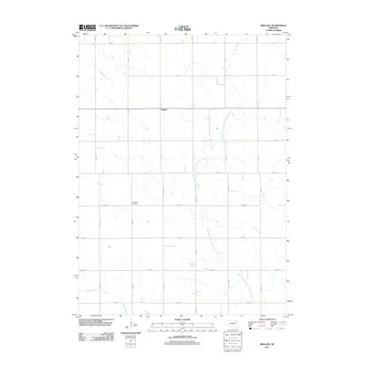
2011 Map of Midland
USGS Topo · Published 2011About this map
Midland sits at the heart of this Knox County landscape, where the agricultural grid meets the winding course of the West Branch North Fork Elkhorn River. The terrain is defined by the intersection of numerous section roads, such as 870 Rd and 542 Ave, which carve the prairie into a patchwork of productive fields. This 2011 survey captures the area’s rural character, anchored by local landmarks like the Eden Valley Cemetery in the southern portion of the quadrangle. Drainage patterns are shaped by several small watercourses, including Breslau Creek, which flows through the southwestern corner. The mapping detail shows the persistence of small rural settlements and burial grounds that serve as vital links for family history research in this part of Nebraska.
Find a feature on this map
25 named features on this map. Tap any name to fly to it.
Don’t see what you’re looking for? This feature index may not catch every label — zoom into the map to look around manually.
Map Details
Editions of this 2011 Midland Map
This is the sole edition of this map. No revisions or reprints were ever made.
Other maps of this area

1955 · Sioux City
USGS Topo · 1:250,000

1958 · Sioux City
USGS Topo · 1:250,000

1959 · Sioux City
USGS Topo · 1:250,000

1963 · Plainview
USGS Topo · 1:24,000

1963 · Foster
USGS Topo · 1:24,000

1963 · Osmond
USGS Topo · 1:24,000

1968 · Bloomfield SE
USGS Topo · 1:24,000

1971 · Wausa
USGS Topo · 1:24,000

1974 · Midland
USGS Topo · 1:24,000

1974 · Bloomfield
USGS Topo · 1:24,000