
1963 Map of Osmond
USGS Topo · Published 1964About this map
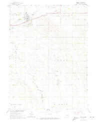
Osmond sits at a critical junction in northeastern Nebraska, where the Chicago and North Western railway follows the valley of the North Fork Elkhorn River. This early 1960s survey documents the agricultural layout of the region, organized into distinct rural townships and terrain units like Plum Grove, Logan, and Thompson. The map preserves the locations of vital community institutions, from the Logan Pride Sch in the southeast to the trio of burial grounds serving the town: Osmond Cem, St Marys Cem, and Immanuel Cem. Beyond the cultivated fields, the landscape is defined by the winding paths of East Branch Quincy Creek and Dry Creek, alongside several industrial Gravel Pit operations that suggest the local extraction economy of the mid-century period.
Find a feature on this map
24 named features on this map. Tap any name to fly to it.
Don’t see what you’re looking for? This feature index may not catch every label — zoom into the map to look around manually.
Map Details
Editions of this 1963 Osmond Map
2 editions found
Other maps of this area

1955 · Sioux City
USGS Topo · 1:250,000

1958 · Sioux City
USGS Topo · 1:250,000

1959 · Sioux City
USGS Topo · 1:250,000

1963 · Pierce NW
USGS Topo · 1:24,000

1963 · Foster
USGS Topo · 1:24,000

1963 · Wee Town
USGS Topo · 1:24,000
1963 · Pierce
USGS Topo · 1:24,000

1971 · Wausa
USGS Topo · 1:24,000
1971 · Randolph SW
USGS Topo · 1:24,000
1971 · Magnet
USGS Topo · 1:24,000