
1974 Map of Midland
USGS Topo · Published 1978About this map
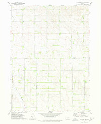
Midland and Breslau anchor this agricultural landscape in northeast Nebraska during the mid-1970s. The terrain is defined by the winding course of the West Branch North Fork Elkhorn River and its tributary, Breslau Creek, which drain the undulating plains. The map provides a precise record of rural life and community landmarks, such as Golgotha Ch and the Eden Valley Cem, which serve as vital touchstones for family historians. The boundary between Knox and Pierce counties bisects the region, where a network of section roads connects isolated farmsteads. To the northeast, the Rolling Hills Country Club represents a more modern recreational development amidst the traditional farming blocks and numerous local wells.
Find a feature on this map
9 named features on this map. Tap any name to fly to it.
Don’t see what you’re looking for? This feature index may not catch every label — zoom into the map to look around manually.
Map Details
Editions of this 1974 Midland Map
This is the sole edition of this map. No revisions or reprints were ever made.
Other maps of this area

1955 · Sioux City
USGS Topo · 1:250,000

1958 · Sioux City
USGS Topo · 1:250,000

1959 · Sioux City
USGS Topo · 1:250,000

1963 · Plainview
USGS Topo · 1:24,000

1963 · Foster
USGS Topo · 1:24,000

1963 · Osmond
USGS Topo · 1:24,000

1968 · Bloomfield SE
USGS Topo · 1:24,000

1971 · Wausa
USGS Topo · 1:24,000

1974 · Bloomfield
USGS Topo · 1:24,000
1974 · Plainview NE
USGS Topo · 1:24,000