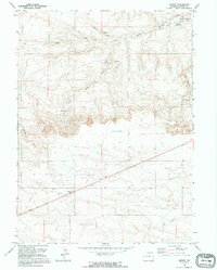
1991 Map of Midway
USGS Topo · Published 1995About this map
Midway and the surrounding high plains of Laramie County are defined by a complex network of intermittent water sources and ranching infrastructure. This survey illustrates how essential water management was to the region's cattle industry, with named sites like Donahue Reservoir, Donahue Spring, and Bull Spring serving as focal points for land use. The presence of specialized landmarks like Rhodes Windmill and The South Windmill further underscores the reliance on groundwater for sustaining the area's homesteads and herds.
Find a feature on this map
17 named features on this map. Tap any name to fly to it.
Don’t see what you’re looking for? This feature index may not catch every label — zoom into the map to look around manually.
Map Details
Editions of this 1991 Midway Map
This is the sole edition of this map. No revisions or reprints were ever made.
Other maps of this area

1899 · Goshen Hole
USGS Topo · 1:125,000

1911 · Cheyenne
USGS Topo · 1:125,000

1914 · Cheyenne
USGS Topo · 1:125,000

1954 · Cheyenne
USGS Topo · 1:250,000

1958 · Cheyenne
USGS Topo · 1:250,000

1960 · Rocky Hollow
USGS Topo · 1:24,000

1960 · Meriden
USGS Topo · 1:24,000

1963 · Little Indian Draw
USGS Topo · 1:24,000

1963 · Pole Creek Ranch SE
USGS Topo · 1:24,000

1963 · Midway
USGS Topo · 1:24,000