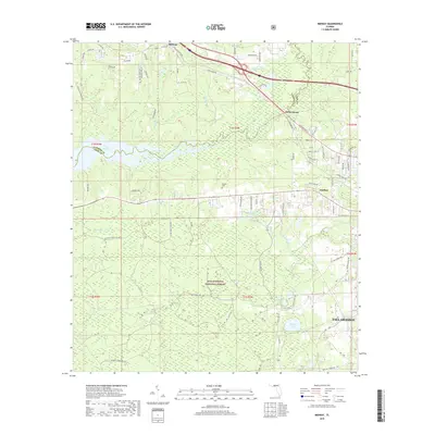
2018 Map of Midway
USGS Topo · Published 2018About this map
The Ochlockonee River forms a natural boundary on this 2018 survey, separating the rural communities of Midway and Ochlockonee as it flows toward the expansive Lake Talquin in the west. Much of the southern landscape is occupied by the Apalachicola National Forest, a territory dotted with numerous water bodies like Silver Lake, Andrew Lake, and Campground Pond.
Find a feature on this map
80 named features on this map. Tap any name to fly to it.
Don’t see what you’re looking for? This feature index may not catch every label — zoom into the map to look around manually.
Map Details
Editions of this 2018 Midway Map
This is the sole edition of this map. No revisions or reprints were ever made.
Other maps of this area

1940 · Tallahassee
USGS Topo · 1:62,500

1942 · Tallahassee
USGS Topo · 1:62,500

1943 · Tallahassee
USGS Topo · 1:62,500

1943 · Lake Talquin
USGS Topo · 1:62,500

1954 · Tallahassee
USGS Topo · 1:250,000

1959 · Tallahassee
USGS Topo · 1:250,000

1959 · Quincy
USGS Topo · 1:24,000

1960 · Tallahassee
USGS Topo · 1:250,000

1963 · Lake Jackson
USGS Topo · 1:24,000
1963 · Havana South
USGS Topo · 1:24,000