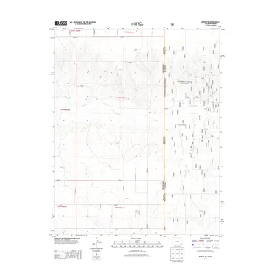
2013 Map of Midway SE
USGS Topo · Published 2013About this map
The Cimarron River carves a winding path through this high plains borderland, where the open prairie of Baca County meets the Cimarron National Grassland. This 2013 survey reveals a landscape organized by the Public Land Survey System, with a rigid grid of local routes like Co Road K and Co Road B defining the agricultural and grazing tracts. The topography is marked by the river's erosion, creating a complex network of draws and breaks that contrast with the flat upland plains. Industrial activity is centered on the Interstate Oil Field in the eastern portion of the map, illustrating the region's reliance on natural resource extraction alongside its ranching heritage. This map provides a clear view of the state line between Colorado and Kansas, documenting the intersection of federal land management and private industry in the early 21st century.
Find a feature on this map
19 named features on this map. Tap any name to fly to it.
Don’t see what you’re looking for? This feature index may not catch every label — zoom into the map to look around manually.
Map Details
Editions of this 2013 Midway SE Map
This is the sole edition of this map. No revisions or reprints were ever made.
Other maps of this area

1892 · Vilas
USGS Topo · 1:125,000

1954 · Perryton
USGS Topo · 1:250,000

1954 · Dalhart
USGS Topo · 1:250,000

1955 · La Junta
USGS Topo · 1:250,000

1955 · Dodge City
USGS Topo · 1:250,000

1958 · Perryton
USGS Topo · 1:250,000

1958 · La Junta
USGS Topo · 1:250,000

1958 · Dodge City
USGS Topo · 1:250,000

1958 · Dalhart
USGS Topo · 1:250,000

1959 · Dodge City
USGS Topo · 1:250,000