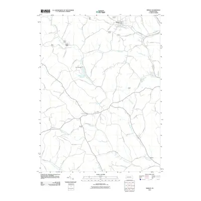
2010 Map of Midway
USGS Topo · Published 2010About this map
Midway and its surrounding communities are defined by a complex drainage network where Raccoon Creek and Robinson Run carve through the Washington County hills. Local infrastructure is heavily influenced by former rail corridors, now preserved as The Panhandle Trl and The Montour Trl. Significant engineering features are visible throughout the landscape, including the Acheson Tunnel, Hickory Tunnel, and McGugin Tunnel, which allowed transportation routes to traverse the ridgelines. The northern portion of the map highlights the community of Cherry Valley, centered around the Cherry Valley Reservoir and the Cherry Valley Dam. Aviation history is noted by the presence of Cataney Airport and Lofferts Airport, while genealogical interest is anchored by the Cherry Valley Cemetery and Center Cemetery. This era shows the region transitioning from its industrial and mining roots toward a landscape of rural residences and recreational trail systems.
Find a feature on this map
85 named features on this map. Tap any name to fly to it.
Don’t see what you’re looking for? This feature index may not catch every label — zoom into the map to look around manually.
Map Details
Editions of this 2010 Midway Map
This is the sole edition of this map. No revisions or reprints were ever made.
Other maps of this area

1901 · Amity
USGS Topo · 1:62,500

1904 · Amity
USGS Topo · 1:62,500

1904 · Carnegie
USGS Topo · 1:62,500

1904 · Burgettstown
USGS Topo · 1:62,500

1906 · Burgettstown
USGS Topo · 1:62,500

1906 · Carnegie
USGS Topo · 1:62,500

1907 · Claysville
USGS Topo · 1:62,500

1908 · Carnegie
USGS Topo · 1:62,500

1951 · Canton
USGS Topo · 1:250,000

1953 · Canton
USGS Topo · 1:250,000
Featured Places
- Cecil Township, PA
- Robinson Township, PA
- Cross Creek Township, PA
- Midway, PA
- Cherry Valley, Smith Township