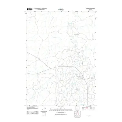
2012 Map of Midwest
USGS Topo · Published 2012About this map
Midwest and its industrial surroundings define this Wyoming landscape, where the legacy of energy production is etched into the terrain. The community is central to the extensive Salt Creek Oil Field and the nearby Shannon Pool Oil Field, revealing an environment heavily shaped by decades of resource extraction. Local infrastructure supports this industry, with roads like Gas Plant Rd and Light Plant Rd serving the facilities, while residential life is anchored by named streets such as Navy Row and Stock St.
Find a feature on this map
20 named features on this map. Tap any name to fly to it.
Don’t see what you’re looking for? This feature index may not catch every label — zoom into the map to look around manually.
Map Details
Editions of this 2012 Midwest Map
This is the sole edition of this map. No revisions or reprints were ever made.
Other maps of this area

1954 · Linch
USGS Topo · 1:24,000

1955 · Arminto
USGS Topo · 1:250,000

1958 · Arminto
USGS Topo · 1:250,000

1959 · Edgerton
USGS Topo · 1:62,500

1961 · Dugout Ranch
USGS Topo · 1:24,000

1961 · Dead Woman Crossing
USGS Topo · 1:24,000

1962 · Arminto
USGS Topo · 1:250,000

1968 · Big Gulch
USGS Topo · 1:24,000

1968 · Midwest
USGS Topo · 1:24,000

1968 · Salt Creek
USGS Topo · 1:24,000