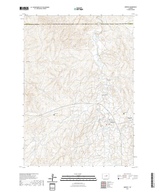
2021 Map of Midwest
USGS Topo · Published 2021About this map
Midwest and Edgerton serve as the primary residential hubs in this portion of central Wyoming, situated just south of the Johnson County and Natrona County line. The landscape is heavily defined by drainage systems and man-made water management, with Salt Creek winding through the center, feeding into the Lower Salt Creek Reservoir. The presence of Gas Plant Road and industrial infrastructure near the Midwest Number 2 Reservoir suggests the area's long-standing connection to local energy production.
Find a feature on this map
26 named features on this map. Tap any name to fly to it.
Don’t see what you’re looking for? This feature index may not catch every label — zoom into the map to look around manually.
Map Details
Editions of this 2021 Midwest Map
This is the sole edition of this map. No revisions or reprints were ever made.
Other maps of this area

1954 · Linch
USGS Topo · 1:24,000

1955 · Arminto
USGS Topo · 1:250,000

1958 · Arminto
USGS Topo · 1:250,000

1959 · Edgerton
USGS Topo · 1:62,500

1961 · Dugout Ranch
USGS Topo · 1:24,000

1961 · Dead Woman Crossing
USGS Topo · 1:24,000

1962 · Arminto
USGS Topo · 1:250,000

1968 · Big Gulch
USGS Topo · 1:24,000

1968 · Midwest
USGS Topo · 1:24,000

1968 · Salt Creek
USGS Topo · 1:24,000