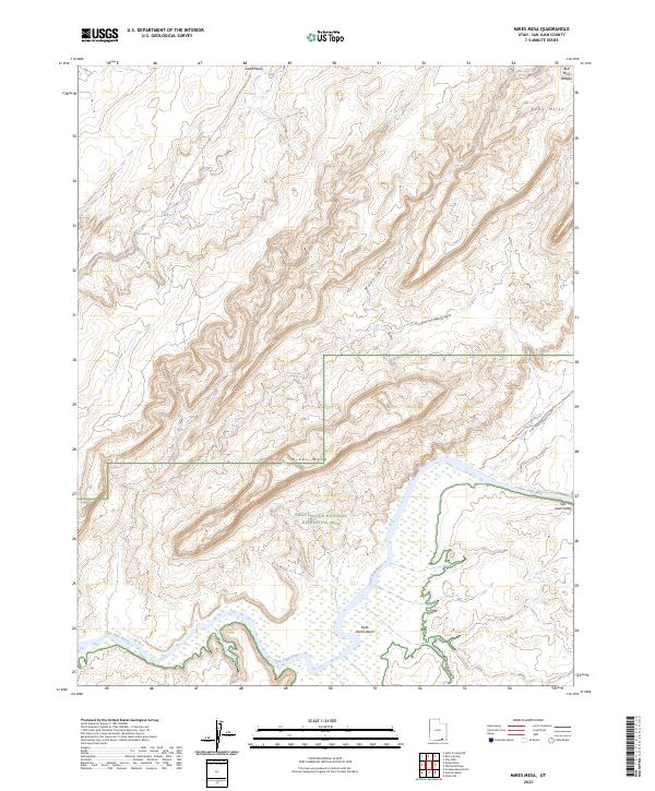
2023 Map of Mikes Mesa
USGS Topo · Published 2023About this map
The San Juan River snakes through a deeply dissected landscape of plateaus and canyons within the Glen Canyon National Recreation Area. This area of San Juan County is defined by its dramatic verticality, where the Mikes Mesa and the Clay Hills stand as prominent markers above the drainage systems of Piute Farms Wash and Rockhouse Gulch. The terrain is characterized by complex hydrological patterns, from the seasonal flow of Castle Wash to the permanent namesake flow of the river.
Find a feature on this map
15 named features on this map. Tap any name to fly to it.
Don’t see what you’re looking for? This feature index may not catch every label — zoom into the map to look around manually.
Map Details
Editions of this 2023 Mikes Mesa Map
This is the sole edition of this map. No revisions or reprints were ever made.
Other maps of this area

1886 · Henry Mountains
USGS Topo · 1:250,000

1892 · Henry Mountains
USGS Topo · 1:250,000

1952 · Clay Hills 3 NW
USGS Topo · 1:24,000

1952 · Navajo Mountain 4 NE
USGS Topo · 1:24,000

1952 · Oljeto
USGS Topo · 1:62,500

1953 · Lake Canyon
USGS Topo · 1:62,500

1953 · No Mans Mesa
USGS Topo · 1:62,500

1954 · Clay Hills 2 SW
USGS Topo · 1:24,000

1954 · Clay Hills 2 NW
USGS Topo · 1:24,000
1954 · Clay Hills 3 NE
USGS Topo · 1:24,000