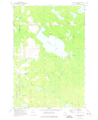
1972 Map of Milakokia Lake
USGS Topo · Published 1975About this map
Milakokia Lake dominates this Upper Peninsula landscape during the mid-1970s, revealing a region defined by industrial extraction and the timber-focused legacy of the Mackinac State Forest. The western shore of the lake is marked by a significant Quarry and associated industrial zones, including restricted areas that speak to the local economy's reliance on mineral resources. Transportation networks are prominent, featuring the active Soo Line and remnants of an Old Railroad Grade that once hauled logs and stone through these wetlands. Small settlements like Huntspur and Inland provide anchors for local history, while several family-named water bodies such as Rubys Bay and Heinz Lake suggest a long-standing local connection to the land. The presence of Pike Lake Station and various Flowing Wells further details the infrastructure supporting those who lived and worked in this marshy, forested territory.
Find a feature on this map
40 named features on this map. Tap any name to fly to it.
Don’t see what you’re looking for? This feature index may not catch every label — zoom into the map to look around manually.
Map Details
Editions of this 1972 Milakokia Lake Map
This is the sole edition of this map. No revisions or reprints were ever made.
Other maps of this area

1931 · Seul Choix Point NE
USGS Topo · 1:31,680

1931 · Gould City NW
USGS Topo · 1:31,680

1931 · Seul Choix Point NW
USGS Topo · 1:31,680

1931 · Blaney SW
USGS Topo · 1:31,680

1931 · Blaney NE
USGS Topo · 1:31,680

1931 · Blaney SE
USGS Topo · 1:31,680

1931 · Blaney NW
USGS Topo · 1:31,680

1954 · Sault Sainte Marie
USGS Topo · 1:250,000

1955 · Cheboygan
USGS Topo · 1:250,000

1956 · Sault Sainte Marie
USGS Topo · 1:250,000