
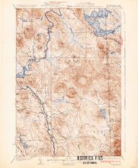
1934 Map of Milan
USGS Topo · Published 1934About this map
Milan and the surrounding timberlands of Coos County are captured here just as the early 1930s industrial footprint settled into the landscape. The Androscoggin River serves as the central artery for this territory, flowing south through the Pontook Reservoir and past the active Berlin Landing Field. While the village of Milan anchors the local commerce, the map reveals a decentralized network of rural education, identifying remote schoolhouses such as the Jewett Sch, Willis Sch, and Milan Hill Sch that served the era’s dispersed logging and farming families.
Find a feature on this map
84 named features on this map. Tap any name to fly to it.
Don’t see what you’re looking for? This feature index may not catch every label — zoom into the map to look around manually.
Map Details
Editions of this 1934 Milan Map
2 editions found
Other maps of this area

1893 · Mt. Washington
USGS Topo · 1:62,500

1893 · Gorham
USGS Topo · 1:62,500

1896 · Mt. Washington
USGS Topo · 1:62,500

1896 · Gorham
USGS Topo · 1:62,500

1914 · Bethel
USGS Topo · 1:62,500

1930 · Milan
USGS Topo · 1:62,500

1930 · Percy
USGS Topo · 1:62,500

1930 · Dixville
USGS Topo · 1:62,500

1930 · Errol
USGS Topo · 1:62,500

1933 · Dixville
USGS Topo · 1:62,500