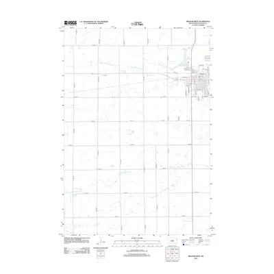
2012 Map of Milbank West
USGS Topo · Published 2012About this map
Milbank anchors the northeastern portion of this Grant County landscape, where the grid of city streets transitions into the expansive agricultural sections of eastern South Dakota. The town's layout is defined by its relationship to transportation and industry, with corridors such as E Railway Ave and Industrial Dr reflecting its local economic base. Just outside the main residential blocks, Lake Farley provides a distinct recreational water feature near the winding path of the S Fork Whetstone River.
Find a feature on this map
38 named features on this map. Tap any name to fly to it.
Don’t see what you’re looking for? This feature index may not catch every label — zoom into the map to look around manually.
Map Details
Editions of this 2012 Milbank West Map
This is the sole edition of this map. No revisions or reprints were ever made.
Other maps of this area

1953 · Milbank
USGS Topo · 1:250,000

1954 · Big Stone Lake
USGS Topo · 1:62,500

1958 · Milbank
USGS Topo · 1:250,000

1971 · Corona
USGS Topo · 1:24,000

1971 · Big Stone Lake SE
USGS Topo · 1:24,000

1971 · Big Stone Lake SW
USGS Topo · 1:24,000

1973 · Twin Brooks
USGS Topo · 1:24,000

1973 · LaBolt
USGS Topo · 1:24,000
1973 · Milbank West
USGS Topo · 1:24,000

1973 · Stockholm
USGS Topo · 1:24,000