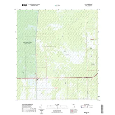
2018 Map of Miles City
USGS Topo · Published 2018About this map
Miles City sits at the intersection of local transport and conservation lands in this 2018 survey of the Florida Everglades. The landscape is dominated by the sprawling Florida Panther National Wildlife Refuge and the Big Cypress National Preserve, where the wet terrain is defined by strands and sloughs. Indigenous history is physically marked on the land at the East Hinson Indian Mounds located near East Hinson Island.
Find a feature on this map
29 named features on this map. Tap any name to fly to it.
Don’t see what you’re looking for? This feature index may not catch every label — zoom into the map to look around manually.
Map Details
Editions of this 2018 Miles City Map
This is the sole edition of this map. No revisions or reprints were ever made.
Other maps of this area

1956 · West Palm Beach
USGS Topo · 1:250,000

1957 · West Palm Beach
USGS Topo · 1:250,000

1958 · West Palm Beach
USGS Topo · 1:250,000

1958 · Catherine Island
USGS Topo · 1:24,000

1958 · Sunniland
USGS Topo · 1:24,000

1958 · Immokalee SW
USGS Topo · 1:24,000

1959 · Miles City
USGS Topo · 1:24,000

1959 · Deep Lake
USGS Topo · 1:24,000

1959 · Deep Lake SW
USGS Topo · 1:24,000
1962 · Catherine Island
USGS Topo · 1:24,000