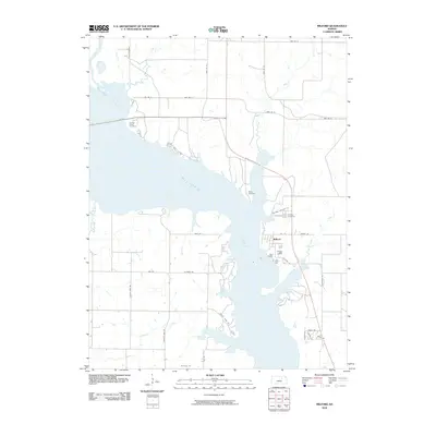
2010 Map of Milford
USGS Topo · Published 2010About this map
The expansive Milford Lake dominates this central Kansas landscape, where the waters of the Republican River meet a complex of flooded inlets and creek arms. The settlement of Milford sits on the eastern shore, positioned along a network of local roads such as Houston Rd and Milford Cemetery Rd. This topography reflects the significant hydrological changes that occurred in Geary County during the mid-20th century, as the landscape transitioned from traditional riverbottom farming to a reservoir-based economy.
Find a feature on this map
36 named features on this map. Tap any name to fly to it.
Don’t see what you’re looking for? This feature index may not catch every label — zoom into the map to look around manually.
Map Details
Editions of this 2010 Milford Map
This is the sole edition of this map. No revisions or reprints were ever made.
Other maps of this area

1886 · Junction City
USGS Topo · 1:125,000

1889 · Junction City
USGS Topo · 1:125,000

1891 · Clay Center
USGS Topo · 1:125,000

1894 · Junction City
USGS Topo · 1:125,000

1947 · Fort Riley
USGS Topo · 1:62,500

1950 · Junction City
USGS Topo · 1:24,000

1950 · Alida
USGS Topo · 1:24,000

1951 · Wind Creek
USGS Topo · 1:24,000

1951 · Milford
USGS Topo · 1:24,000

1955 · Fort Riley NE
USGS Topo · 1:24,000