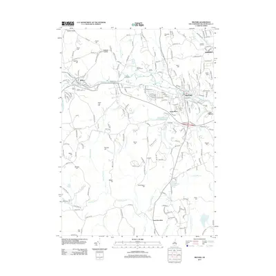
2012 Map of Milford
USGS Topo · Published 2012About this map
Milford serves as the central hub of this South-Central New Hampshire landscape, where the Souhegan River winds through a valley defined by numerous tributary brooks and hills. The map highlights the town's growth beyond the historic center into South Milford and East Milford, alongside neighboring Wilton and the edge of Amherst. The local economy and leisure are reflected in the presence of the Milford Fish Hatchery and the Milford Twin Drive-In, which stand in contrast to the numerous quiet burial grounds such as Meadow View Cem and Riverside Cem.
Find a feature on this map
214 named features on this map. Tap any name to fly to it.
Don’t see what you’re looking for? This feature index may not catch every label — zoom into the map to look around manually.
Map Details
Editions of this 2012 Milford Map
This is the sole edition of this map. No revisions or reprints were ever made.
Other maps of this area

1887 · Fitchburg
USGS Topo · 1:62,500

1889 · Fitchburg
USGS Topo · 1:62,500

1893 · Fitchburg
USGS Topo · 1:62,500

1893 · Groton
USGS Topo · 1:62,500

1900 · Peterboro
USGS Topo · 1:62,500

1906 · Milford
USGS Topo · 1:62,500

1931 · Groton
USGS Topo · 1:48,000

1931 · Fitchburg
USGS Topo · 1:48,000

1935 · Groton
USGS Topo · 1:62,500

1935 · Fitchburg
USGS Topo · 1:62,500