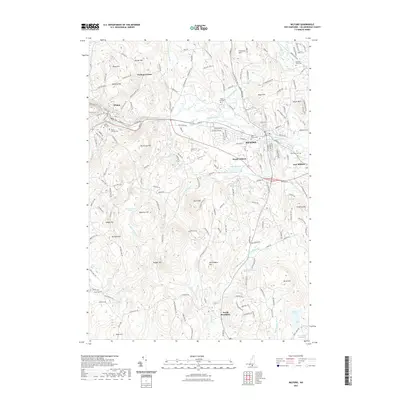
2021 Map of Milford
USGS Topo · Published 2021About this map
The Souhegan River carves a central path through this Hillsborough County landscape, anchoring the industrial and residential hubs of Milford, Wilton, and East Milford. The terrain is defined by a series of named elevations such as Burns Hill, Abbot Hill, and Pead Hill, which historically influenced the winding road network connecting rural outposts like Perham Corner. These hills separate the various drainage basins of Great Brook, Tucker Brook, and Spaulding Brook.
Find a feature on this map
187 named features on this map. Tap any name to fly to it.
Don’t see what you’re looking for? This feature index may not catch every label — zoom into the map to look around manually.
Map Details
Editions of this 2021 Milford Map
This is the sole edition of this map. No revisions or reprints were ever made.
Other maps of this area

1887 · Fitchburg
USGS Topo · 1:62,500

1889 · Fitchburg
USGS Topo · 1:62,500

1893 · Fitchburg
USGS Topo · 1:62,500

1893 · Groton
USGS Topo · 1:62,500

1900 · Peterboro
USGS Topo · 1:62,500

1906 · Milford
USGS Topo · 1:62,500

1931 · Groton
USGS Topo · 1:48,000

1931 · Fitchburg
USGS Topo · 1:48,000

1935 · Groton
USGS Topo · 1:62,500

1935 · Fitchburg
USGS Topo · 1:62,500