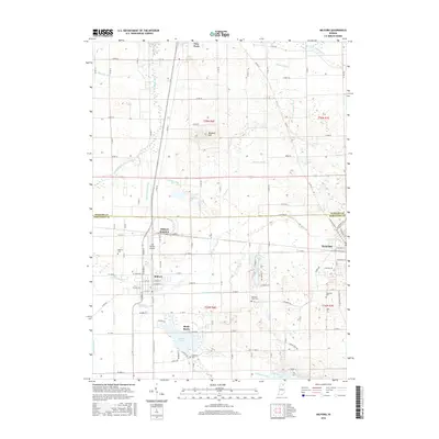
2016 Map of Milford
USGS Topo · Published 2016About this map
Milford and the surrounding farmland of northern Indiana are defined by a complex network of drainage infrastructure and small lakeside communities. In the southern portion of the quadrangle, the terrain transitions into the kettle lake region, featuring Waubee Lake and the northern edge of Dewart Lake. The settlement of Shady Banks and several historic burial grounds, including Lakeside Cem and Tamarack Cem, provide points of interest for genealogists tracing local families in this corner of Kosciusko County. A dense system of agricultural waterways, such as Hoopingarner Ditch, Kieffer Ditch, and Whetten Ditch, crisscross the landscape to manage the high water table characteristic of this glacial geography. Industrial and transport activity centers on Milford Junction, where rail lines intersect near the HR Weisser Airport, while the town of Syracuse anchors the eastern edge of the survey.
Find a feature on this map
146 named features on this map. Tap any name to fly to it.
Don’t see what you’re looking for? This feature index may not catch every label — zoom into the map to look around manually.
Map Details
Editions of this 2016 Milford Map
This is the sole edition of this map. No revisions or reprints were ever made.
Other maps of this area

1950 · Leesburg
USGS Topo · 1:24,000

1950 · North Webster
USGS Topo · 1:24,000

1951 · Milford
USGS Topo · 1:24,000

1951 · Wawasee
USGS Topo · 1:24,000

1953 · Fort Wayne
USGS Topo · 1:250,000

1956 · Fort Wayne
USGS Topo · 1:250,000

1958 · Nappanee East
USGS Topo · 1:24,000

1959 · Atwood
USGS Topo · 1:24,000

1959 · Millersburg
USGS Topo · 1:24,000

1959 · Goshen
USGS Topo · 1:24,000