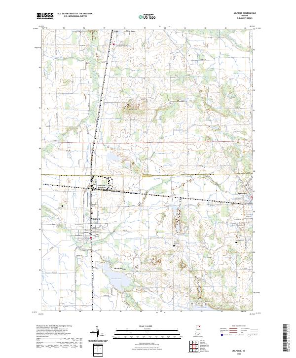
2022 Map of Milford
USGS Topo · Published 2022About this map
The agricultural landscape of northern Indiana is defined here by an intricate network of drainage ditches and glaciated lakes. Milford and Syracuse serve as the primary hubs, while the community of Shady Banks sits along the northern shore of Waubee Lake. The rail infrastructure of the Norfolk Southern passes through Milford Junction, underscoring the area's historical reliance on transport to move local yields.
Find a feature on this map
74 named features on this map. Tap any name to fly to it.
Don’t see what you’re looking for? This feature index may not catch every label — zoom into the map to look around manually.
Map Details
Editions of this 2022 Milford Map
This is the sole edition of this map. No revisions or reprints were ever made.
Other maps of this area

1950 · Leesburg
USGS Topo · 1:24,000

1950 · North Webster
USGS Topo · 1:24,000

1951 · Milford
USGS Topo · 1:24,000

1951 · Wawasee
USGS Topo · 1:24,000

1953 · Fort Wayne
USGS Topo · 1:250,000

1956 · Fort Wayne
USGS Topo · 1:250,000

1958 · Nappanee East
USGS Topo · 1:24,000

1959 · Atwood
USGS Topo · 1:24,000

1959 · Millersburg
USGS Topo · 1:24,000

1959 · Goshen
USGS Topo · 1:24,000