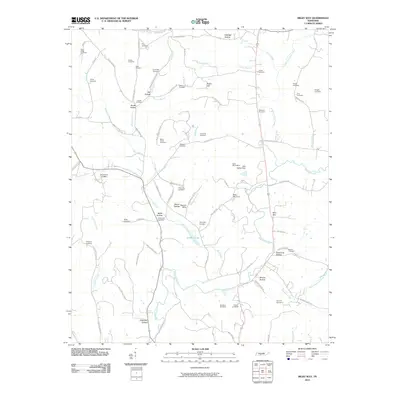
2010 Map of Milky Way
USGS Topo · Published 2010About this map
Milky Way Farm and the associated Mars Mausoleum anchor this landscape, reflecting the significant regional footprint of the famous confectionery family's estate. The terrain is defined by a dense network of hollows and ridges, such as African Hollow and Eldridge Hollow, where small family burial grounds and communities like Pleasant Valley are tucked away. Numerous cemeteries, including Briar Ridge Cemetery, Yokley Cemetery, and Dickerson Cemetery, provide a detailed genealogical record of the rural families settled among the tributaries of Richland Creek and Robertson Fork Creek. The CSX railroad line runs north-to-south, paralleling the main roads and connecting these agricultural spaces. Notable water features like Sanders Lake and the Lake Galilee Dam near the Milky Way settlement demonstrate how local hydrology was modified for both utility and estate development.
Find a feature on this map
91 named features on this map. Tap any name to fly to it.
Don’t see what you’re looking for? This feature index may not catch every label — zoom into the map to look around manually.
Map Details
Editions of this 2010 Milky Way Map
This is the sole edition of this map. No revisions or reprints were ever made.
Other maps of this area

1936 · Sandy Hook
USGS Topo · 1:24,000

1936 · Milky Way
USGS Topo · 1:24,000

1936 · Campbellsville
USGS Topo · 1:24,000

1936 · Brick Church
USGS Topo · 1:24,000

1936 · Campbells Station
USGS Topo · 1:24,000

1936 · Pulaski
USGS Topo · 1:24,000

1936 · Bodenham
USGS Topo · 1:24,000

1936 · Tarpley
USGS Topo · 1:24,000

1936 · Lynnville
USGS Topo · 1:24,000

1946 · Brick Church
USGS Topo · 1:24,000