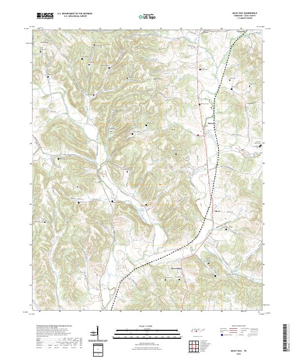
2022 Map of Milky Way
USGS Topo · Published 2022About this map
Richland Creek and its many tributaries, including Minnow Br and Whitaker Br, carve a complex landscape of hollows and ridges across this part of Giles County. Small settlements such as Lynnville and Riversburg anchor the local geography, connected by a network of rural routes like Milky Way Rd and Campbellsville Rd. The area is notably dense with small family and community burial sites, from the Tinnon Burial Ground to the Mars Mausoleum Cem, suggesting a long history of generational land ownership. These cemeteries, alongside landmarks like Hopewell Church, are often tucked into named terrain features such as Miller Hollow, Eldridge Hollow, and African Hollow. The presence of Sanders Lake and the various forks of Robertson Fork Cr highlight the importance of water management in this agricultural and residential region.
Find a feature on this map
116 named features on this map. Tap any name to fly to it.
Don’t see what you’re looking for? This feature index may not catch every label — zoom into the map to look around manually.
Map Details
Editions of this 2022 Milky Way Map
This is the sole edition of this map. No revisions or reprints were ever made.
Other maps of this area

1936 · Sandy Hook
USGS Topo · 1:24,000

1936 · Milky Way
USGS Topo · 1:24,000

1936 · Campbellsville
USGS Topo · 1:24,000

1936 · Brick Church
USGS Topo · 1:24,000

1936 · Campbells Station
USGS Topo · 1:24,000

1936 · Pulaski
USGS Topo · 1:24,000

1936 · Bodenham
USGS Topo · 1:24,000

1936 · Tarpley
USGS Topo · 1:24,000

1936 · Lynnville
USGS Topo · 1:24,000

1946 · Brick Church
USGS Topo · 1:24,000