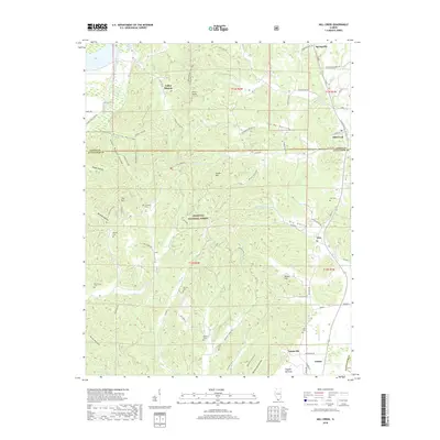
2018 Map of Mill Creek
USGS Topo · Published 2018About this map
Mill Creek and the southern reaches of the Shawnee National Forest define this Illinois landscape where the Ozark Plateau foothills meet the Mississippi River floodplain. The area is characterized by a dense network of hollows and ridges, such as Happy Hollow, Dongola Hollow, and Italian Hill, which create a complex drainage pattern into waterways like Sexton Cr and Sandy Cr. The settlement pattern reflects the ruggedness of the terrain, with small communities like Elco and Tatumville situated along the rail corridors that traverse the valleys.
Find a feature on this map
70 named features on this map. Tap any name to fly to it.
Don’t see what you’re looking for? This feature index may not catch every label — zoom into the map to look around manually.
Map Details
Editions of this 2018 Mill Creek Map
This is the sole edition of this map. No revisions or reprints were ever made.
Other maps of this area

1920 · Jonesboro
USGS Topo · 1:62,500

1920 · Dongola
USGS Topo · 1:62,500

1923 · Dongola
USGS Topo · 1:62,500

1923 · Jonesboro
USGS Topo · 1:62,500

1931 · Cairo
USGS Topo · 1:62,500

1933 · Cairo
USGS Topo · 1:62,500

1934 · Thebes
USGS Topo · 1:62,500

1939 · Cairo
USGS Topo · 1:62,500

1939 · Thebes
USGS Topo · 1:62,500

1947 · Jonesboro
USGS Topo · 1:62,500