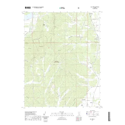
2021 Map of Mill Creek
USGS Topo · Published 2021About this map
Shawnee National Forest encompasses a large portion of this landscape, characterized by a series of named valleys and ridges south of Springville. The rugged interior is marked by numerous hollows, including North Ripple Hollow, Happy Hollow, and You-Be Hollow, suggesting a deeply dissected terrain that influenced early settlement patterns. Family names are preserved throughout the rural landscape in the form of several small burying grounds, such as McCrite Cem and Honey Cem, which lie scattered along the drainage basins of Sexton Cr and Sandy Cr. To the south, the terrain transitions toward Tatumville and Tamms, where the road network becomes more regular near Hogskin Bottoms. Notable local landmarks like Italian Hill and Burner Hill punctuate the ridges between the small communities of Elco and Valley Mission, reflecting the area's complex topography.
Find a feature on this map
69 named features on this map. Tap any name to fly to it.
Don’t see what you’re looking for? This feature index may not catch every label — zoom into the map to look around manually.
Map Details
Editions of this 2021 Mill Creek Map
This is the sole edition of this map. No revisions or reprints were ever made.
Other maps of this area

1920 · Jonesboro
USGS Topo · 1:62,500

1920 · Dongola
USGS Topo · 1:62,500

1923 · Dongola
USGS Topo · 1:62,500

1923 · Jonesboro
USGS Topo · 1:62,500

1931 · Cairo
USGS Topo · 1:62,500

1933 · Cairo
USGS Topo · 1:62,500

1934 · Thebes
USGS Topo · 1:62,500

1939 · Cairo
USGS Topo · 1:62,500

1939 · Thebes
USGS Topo · 1:62,500

1947 · Jonesboro
USGS Topo · 1:62,500