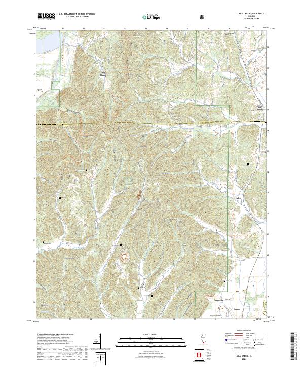
2024 Map of Mill Creek
USGS Topo · Published 2024About this map
Valley Mission and the surrounding woodlands of the Shawnee National Forest anchor this landscape along the border of Union and Alexander counties. The terrain is defined by a dense network of ridges and hollows, including You-Be Hollow, Happy Hollow, and Dongola Hollow, where small settlements like Elco, Tamms, and Tatumville are situated near the southern extent. This area's rural character is underscored by the high density of family and community burial grounds, such as McCrite Cem, Honey Cem, and Sims Cem, which offer significant genealogical touchstones for the region.
Find a feature on this map
81 named features on this map. Tap any name to fly to it.
Don’t see what you’re looking for? This feature index may not catch every label — zoom into the map to look around manually.
Map Details
Editions of this 2024 Mill Creek Map
This is the sole edition of this map. No revisions or reprints were ever made.
Other maps of this area

1920 · Jonesboro
USGS Topo · 1:62,500

1920 · Dongola
USGS Topo · 1:62,500

1923 · Dongola
USGS Topo · 1:62,500

1923 · Jonesboro
USGS Topo · 1:62,500

1931 · Cairo
USGS Topo · 1:62,500

1933 · Cairo
USGS Topo · 1:62,500

1934 · Thebes
USGS Topo · 1:62,500

1939 · Cairo
USGS Topo · 1:62,500

1939 · Thebes
USGS Topo · 1:62,500

1947 · Jonesboro
USGS Topo · 1:62,500