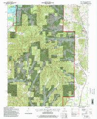
1996 Map of Mill Creek
USGS Topo · Published 1998About this map
Shawnee National Forest dominates this Southern Illinois landscape, where the wooded uplands of the Union and Alexander County line meet the drainage basins of the Mississippi River floodplain. The village of Mill Creek and the settlement at Elco anchor the eastern corridor along the Southern Pacific railroad line, a route that parallels the winding course of Mill Creek. To the west, the terrain transitions into the complex wetlands of the State Conservation Area near Lyerla Lake and the Clear Creek Ditch.
Find a feature on this map
41 named features on this map. Tap any name to fly to it.
Don’t see what you’re looking for? This feature index may not catch every label — zoom into the map to look around manually.
Map Details
Editions of this 1996 Mill Creek Map
This is the sole edition of this map. No revisions or reprints were ever made.
Other maps of this area

1920 · Jonesboro
USGS Topo · 1:62,500

1920 · Dongola
USGS Topo · 1:62,500

1923 · Dongola
USGS Topo · 1:62,500

1923 · Jonesboro
USGS Topo · 1:62,500

1931 · Cairo
USGS Topo · 1:62,500

1933 · Cairo
USGS Topo · 1:62,500

1934 · Thebes
USGS Topo · 1:62,500

1939 · Cairo
USGS Topo · 1:62,500

1939 · Thebes
USGS Topo · 1:62,500

1947 · Jonesboro
USGS Topo · 1:62,500