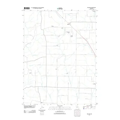
2012 Map of Millard
USGS Topo · Published 2012About this map
The East Fork Little Chariton River carves a path through this northern Missouri landscape, where rural life is defined by a network of gravel roads and small farming communities. Small settlements like Millard, Dart, and Cardy are positioned along the rail and road corridors that connect the region, while the northern edge of La Plata appears in the southeast. The terrain transitions from the elevations of Wyaconda Hills to the drainage basins of Richland Creek and Long Branch.
Find a feature on this map
59 named features on this map. Tap any name to fly to it.
Don’t see what you’re looking for? This feature index may not catch every label — zoom into the map to look around manually.
Map Details
Editions of this 2012 Millard Map
This is the sole edition of this map. No revisions or reprints were ever made.
Other maps of this area

1903 · Edina
USGS Topo · 1:125,000

1908 · Atlanta
USGS Topo · 1:62,500

1937 · Elmer
USGS Topo · 1:48,000

1938 · Kirksville
USGS Topo · 1:62,500

1940 · Kirksville
USGS Topo · 1:62,500

1942 · Elmer
USGS Topo · 1:62,500

1953 · Moberly
USGS Topo · 1:250,000

1954 · Centerville
USGS Topo · 1:250,000

1954 · Moberly
USGS Topo · 1:250,000

1957 · Moberly
USGS Topo · 1:250,000