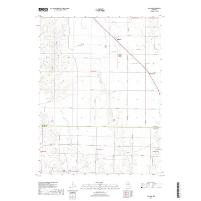
2017 Map of Millard
USGS Topo · Published 2017About this map
E Fork Little Chariton River flows southward through this Missouri landscape, which is divided by the boundary between Adair Co and Macon Co. The town of Millard and the northern edge of La Plata anchor the residential development, while the Kirksville Regional Airport serves as a modern regional hub. Rural life is evidenced by several family-named cemeteries such as Stukey Cem, Shaver Cem, and Shoemaker Cem, which are scattered among the ridges and creek valleys. Numerous local routes like Stukey Cemetery Trl and Flint Trl connect the farms and homesteads. The topography is defined by the drainage patterns of Richland Cr and Turkey Run, revealing a terrain of wooded hollows and productive uplands including the area known as Happy Hollow.
Find a feature on this map
72 named features on this map. Tap any name to fly to it.
Don’t see what you’re looking for? This feature index may not catch every label — zoom into the map to look around manually.
Map Details
Editions of this 2017 Millard Map
This is the sole edition of this map. No revisions or reprints were ever made.
Other maps of this area

1903 · Edina
USGS Topo · 1:125,000

1908 · Atlanta
USGS Topo · 1:62,500

1937 · Elmer
USGS Topo · 1:48,000

1938 · Kirksville
USGS Topo · 1:62,500

1940 · Kirksville
USGS Topo · 1:62,500

1942 · Elmer
USGS Topo · 1:62,500

1953 · Moberly
USGS Topo · 1:250,000

1954 · Centerville
USGS Topo · 1:250,000

1954 · Moberly
USGS Topo · 1:250,000

1957 · Moberly
USGS Topo · 1:250,000