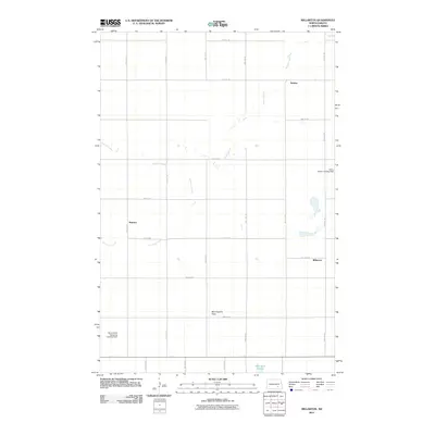
2011 Map of Millarton
USGS Topo · Published 2011About this map
Minneapolis Flats stretches across this landscape in Stutsman County, defined by a grid of rural section roads and small agricultural settlements. The rural character of this North Dakota region is anchored by the small communities of Sydney, Sharlow, and Millarton, which are linked by a network of numbered section lines like 46th St SE and 51st St SE. Waterways such as Buffalo Creek and Cottontail Creek meander through the prairie, eventually leading toward the Wild Rice Slough in the southeast corner. The aerial needs of the local farming economy are reflected in the presence of private airstrips, including the Henry Fietzer Landing Field and Rons Aerial Spraying Landing Field. This 2011 survey captures the area's enduring reliance on the land and the precise organization of the High Plains township system.
Find a feature on this map
17 named features on this map. Tap any name to fly to it.
Don’t see what you’re looking for? This feature index may not catch every label — zoom into the map to look around manually.
Map Details
Editions of this 2011 Millarton Map
This is the sole edition of this map. No revisions or reprints were ever made.
Other maps of this area

1896 · Jamestown
USGS Topo · 1:125,000

1951 · Eldridge SE
USGS Topo · 1:24,000

1952 · Homer
USGS Topo · 1:24,000

1952 · Jud NW
USGS Topo · 1:24,000

1952 · Eldridge SW
USGS Topo · 1:24,000

1953 · Jamestown
USGS Topo · 1:250,000

1953 · Montpelier NW
USGS Topo · 1:24,000

1953 · Jud
USGS Topo · 1:24,000

1953 · Millarton
USGS Topo · 1:24,000

1953 · Nortonville
USGS Topo · 1:24,000