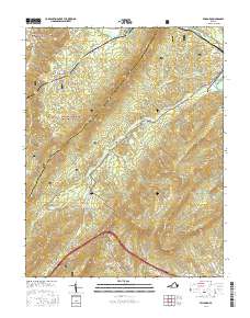
2016 Map of Millboro
USGS Topo · Published 2016About this map
Millboro Springs and the village of Millboro sit at the western edge of a landscape defined by the sharp ridges and deep hollows of the George Washington National Forest. The topography is dominated by massive formations like Mill Mtn and White Rock Mtn, which channel water into intricate drainage systems including Mill Creek and Brattons Run. Transportation through this steep terrain is facilitated by notable engineering, including the Millboro Tunnel and Lick Run Tunnel, which allow rail passage through the mountains. Near the town of Goshen in the northeast, Cold Sulphur Springs Lake marks a localized water feature beneath the slopes of Bratton Mtn. For genealogists, the map preserves the locations of Bratton Cem and The Pines Cem, alongside small settlements like California.
Find a feature on this map
51 named features on this map. Tap any name to fly to it.
Don’t see what you’re looking for? This feature index may not catch every label — zoom into the map to look around manually.
Map Details
Editions of this 2016 Millboro Map
This is the sole edition of this map. No revisions or reprints were ever made.
Other maps of this area

1894 · Staunton
USGS Topo · 1:125,000

1894 · Natural Bridge
USGS Topo · 1:125,000

1894 · Lexington
USGS Topo · 1:125,000

1901 · Monterey
USGS Topo · 1:125,000

1932 · Lexington
USGS Topo · 1:48,000

1937 · Lexington
USGS Topo · 1:62,500

1943 · Craigsville
USGS Topo · 1:62,500

1945 · Craigsville
USGS Topo · 1:62,500

1946 · Millboro
USGS Topo · 1:62,500

1946 · Williamsville
USGS Topo · 1:62,500