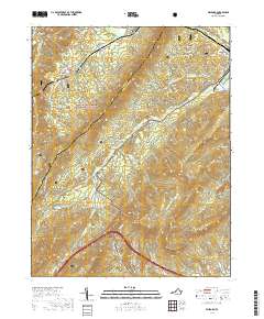
2019 Map of Millboro
USGS Topo · Published 2019About this map
George Washington National Forest blankets the ridges of Bath and Rockbridge Counties in this 2019 survey. The area is defined by its deep mountain gaps and the winding courses of Brattons Run and Mill Creek. The small settlements of Millboro, Millboro Springs, and Goshen anchor the local geography, connected by a network of state routes and historic corridors. The presence of the Millboro Tunnel and Lick Run Tunnel indicates the engineering required to traverse this mountain landscape. Local history is preserved in family-named landmarks such as the Bratton Cem and The Pines Cem, while the location of California suggests a legacy of earlier settlement patterns. The terrain is marked by significant peaks, including Bratton Mtn, Mill Mtn, and White Rock Mtn, which overlook the headwaters of numerous mountain branches like Cold Sulphur Springs Br and Gochenour Br.
Find a feature on this map
59 named features on this map. Tap any name to fly to it.
Don’t see what you’re looking for? This feature index may not catch every label — zoom into the map to look around manually.
Map Details
Editions of this 2019 Millboro Map
This is the sole edition of this map. No revisions or reprints were ever made.
Other maps of this area

1894 · Staunton
USGS Topo · 1:125,000

1894 · Natural Bridge
USGS Topo · 1:125,000

1894 · Lexington
USGS Topo · 1:125,000

1901 · Monterey
USGS Topo · 1:125,000

1932 · Lexington
USGS Topo · 1:48,000

1937 · Lexington
USGS Topo · 1:62,500

1943 · Craigsville
USGS Topo · 1:62,500

1945 · Craigsville
USGS Topo · 1:62,500

1946 · Millboro
USGS Topo · 1:62,500

1946 · Williamsville
USGS Topo · 1:62,500